Learning how to navigate the outdoors using a map and compass is a crucial skill. But how do you use these two tools altogether?
A Quick Overview
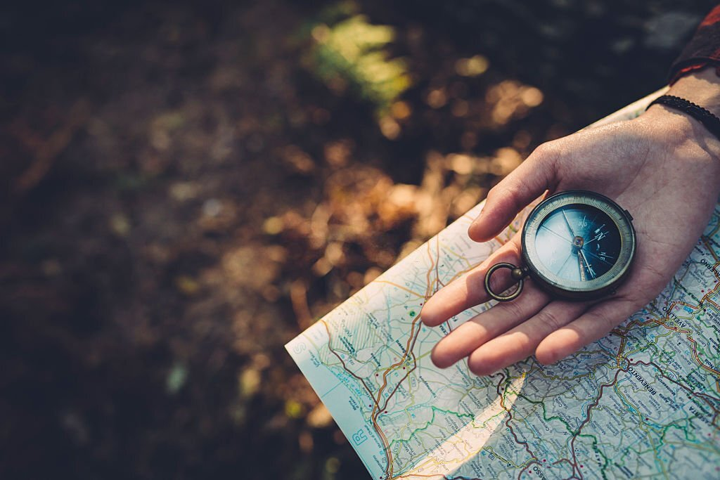
As someone who loves the outdoors, I find great excitement in exploring new places. But to navigate these unknown areas confidently, mastering the skill of finding directions is vital. So, in this post, I will guide you through using a compass and map for effective navigation. Whether you enjoy hiking, camping, or are simply curious about orienteering, this guide will equip you with the necessary knowledge and skills to find your way easily.
Importance of Learning Navigation for Outdoor Activities
When it comes to outdoor activities like hiking, camping, and mountaineering, having good navigation skills is crucial. Let’s see why learning navigation is important for these activities:
Safety and Independence
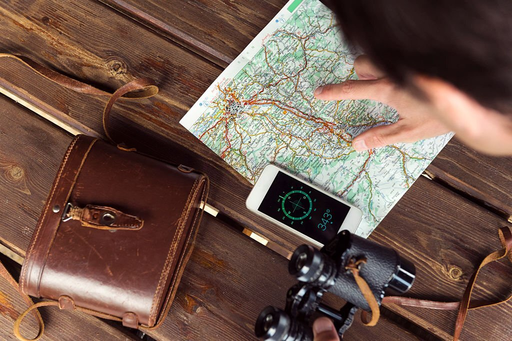
Learning navigation ensures your safety and helps you become self-reliant outdoors. While technology provides us with convenient GPS devices and smartphone apps, relying solely on them can be risky.
Batteries die, signals get lost, and there may be situations where technology is unavailable. By learning navigation with a compass and map, you become less dependent on external devices and gain the ability to navigate effectively even in challenging situations.
Exploration of Uncharted Areas
Outdoor enthusiasts are often drawn to the excitement of exploring uncharted territories and discovering hidden gems in nature. To fully embrace this spirit of exploration, having navigation skills is crucial.
With a compass and map in hand, you can confidently venture into unfamiliar terrain, uncovering beautiful landscapes, secluded trails, and peaceful camping spots off the beaten path. Navigation skills empower you to go beyond marked trails and create your own unforgettable adventures. By the way, orienteering is a sport that relies on these tools.
Route Planning and Decision Making
Navigation skills go hand in hand with route planning and decision making. As an outdoor adventurer, it’s important to plan your routes carefully, considering factors like distance, elevation, terrain difficulty, and water sources.
By studying topographic maps, you can identify potential obstacles, plan alternative routes, and make informed decisions based on the conditions you may encounter. Navigation skills enable you to choose the best paths, optimize your time, and ensure a smoother and more enjoyable experience.
Off-Trail and Wilderness Navigation
For those seeking a deeper connection with nature, off-trail and wilderness navigation add excitement to outdoor activities. These environments often lack marked trails or visible landmarks, requiring you to rely on your navigational abilities.
With a compass and map, you can navigate through dense forests, cross rugged terrains, and traverse vast expanses of wilderness with confidence. Off-trail navigation opens up a whole new world of exploration, allowing you to discover hidden lakes, remote valleys, and untouched wilderness areas.
Emergency Situations and Rescues
While we hope for the best, emergencies can happen during outdoor adventures. In such situations, navigation skills become crucial for self-rescue or aiding others in need. If you become disoriented or lost, using a compass and map can help you reorient yourself and find your way back to safety.
Furthermore, if you encounter fellow adventurers who require assistance, your navigation skills can be valuable in guiding them to safety or providing accurate information about your location to search and rescue teams.
Deepening the Connection with Nature
Finally, learning navigation skills can deepen your connection with nature. By relying on traditional navigation methods, you become more aware of the environment around you. You develop a keen eye for natural landmarks, observe changes in the landscape, and appreciate the subtle signs that nature offers.
Navigation becomes an immersive experience, allowing you to engage with your surroundings in a profound way, fostering a sense of awe, wonder, and respect for the natural world.
Getting Familiar With Your Navigation Tools
Navigating the wilderness requires a good understanding of the tools at your disposal. Let’s dive deeper into understanding your navigation tools—the compass and the map—to maximize their effectiveness in outdoor activities.
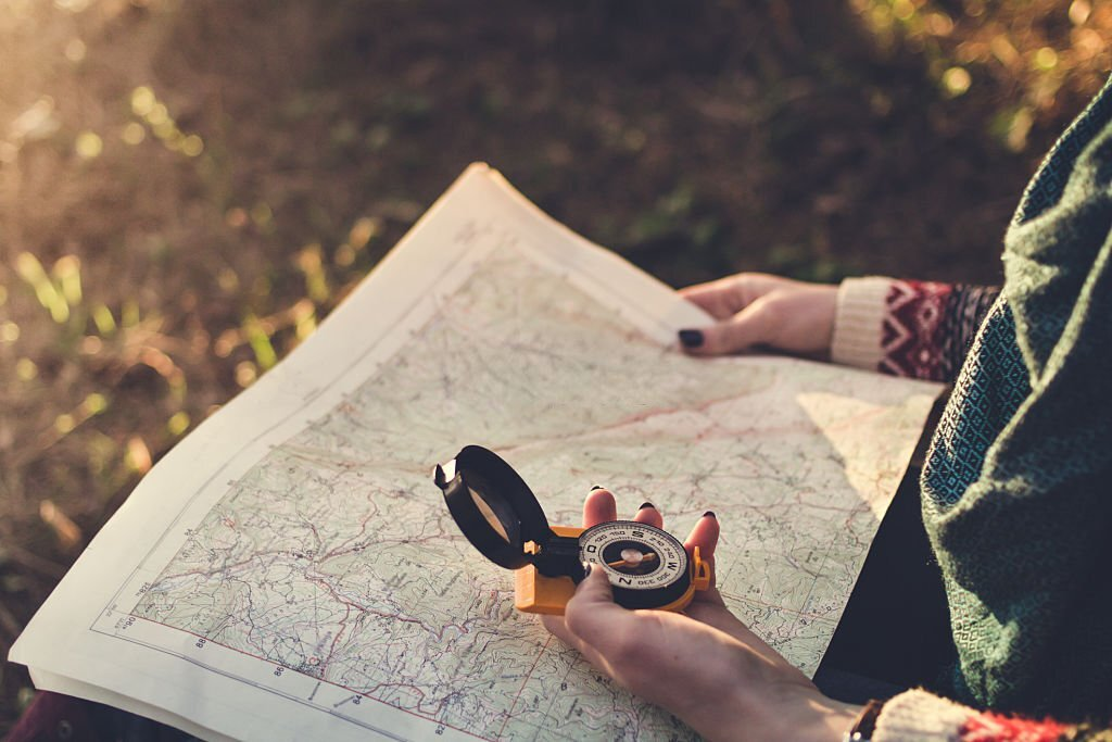
The Compass: Your Reliable Guide
A compass is a time-tested instrument that has guided explorers and adventurers for centuries. To use it effectively, it’s important to understand its components and functionality.
- Magnetic Needle: The magnetic needle is the heart of the compass. It is a magnetized needle that aligns itself with the Earth’s magnetic field, pointing towards the magnetic north. The red end of the needle usually indicates north, while the opposite end points south.
- Rotating Bezel: The rotating bezel is a circular ring surrounding the compass housing. It is marked with degrees or cardinal directions. The bezel allows you to measure angles, take bearings, and establish a reference point for navigation.
- Baseplate: The baseplate of a compass is a transparent plate that allows you to see the map beneath it. It often features rulers and scales to measure distances accurately. The baseplate also has a straight edge that can be used for plotting courses and drawing lines.
- Orienting Arrow: The orienting arrow is a crucial feature on the baseplate. It shows the direction in which the compass should align with the map. Aligning the compass with the orienting arrow ensures that the map and compass are synchronized, facilitating accurate navigation.
READ: How To Use A Hiking Compass
Unfolding the Map: Your Trusty Companion
A map is more than just ink on paper—it is a detailed representation of the terrain you’re navigating. Understanding its elements helps you extract valuable information and plan your routes effectively.
- Legend: The legend, also known as the key, explains the symbols, colors, and markings used on the map. It is important to understand the legend to interpret the map accurately.
- Scale: The scale of a map helps you determine real-world distances represented on the map. By measuring the scale, you can calculate distances between landmarks, estimate travel times, and plan your route accordingly.
- Contours: Contour lines are crucial features on a map. They represent changes in elevation and allow you to visualize the topography of the land. Closely spaced contour lines indicate steep slopes, while widely spaced lines represent flatter terrain.
- Grid Lines: Grid lines divide the map into smaller sections and facilitate coordinate referencing. By using grid lines, you can pinpoint your location, communicate with others more precisely, and navigate more accurately.
READ: How To Read A Topographic Map
| Feature | Compass | Map |
|---|---|---|
| Purpose | Provides directional guidance | Provides visual representation of terrain |
| Key Components | Magnetic needle, rotating bezel, baseplate | Legend, scale, contours, grid lines |
| Functionality | Determines magnetic north, measures bearings | Shows topography, landmarks, and routes |
| Navigation Aid | Offers precise direction in the field | Guides route planning and decision-making |
| Orientation | Aligns with Earth’s magnetic field | Aligns with physical landscape on the ground |
| Accuracy | Can provide accurate direction when used correctly | Depicts accurate geographical information |
| Navigation Technique | Taking bearings, following a set course | Triangulation, resection, dead reckoning |
| Field of Use | Suitable for use in remote and off-grid areas | Applicable in various terrains and environments |
| Portability | Lightweight and portable for ease of carrying | Foldable and compact for convenient storage |
| Backup Navigation | Reliable backup when other methods fail | Essential backup when technology is unreliable |
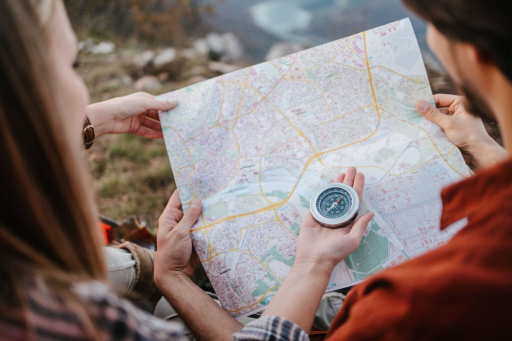
Combining Maps and Compasses For Navigation

While maps and compasses are valuable tools individually, their true power lies in their combination. By integrating the information from a map with the directional guidance of a compass, you can navigate with even greater precision. Let’s explore how to effectively combine maps and compasses for successful navigation.
Step 1: Planning Your Route
Before embarking on your adventure, take the time to plan your route using the map. Consider the following:
- Identify Key Landmarks: Look for prominent landmarks such as mountain peaks, lakes, or distinctive rock formations that you can use as reference points along your journey.
- Trace Your Path: Use a highlighter or your finger to trace your intended route on the map, marking key waypoints and decision points.
- Note Compass Bearings: Along your planned route, identify specific compass bearings or general directions (e.g., northeast, southwest) you need to follow to reach each waypoint.
Step 2: Orienting the Map
When you’re ready to begin your journey, correctly orienting the map is crucial. This ensures that the map aligns with the actual terrain you’re navigating. Follow these steps:
- Find a Fixed Point: Choose a prominent feature in your surroundings, like a hilltop or a distinctive tree, and identify it on both the map and the terrain.
- Align the Map: Rotate the map until the identified feature on the map aligns with the corresponding feature in the terrain. Ensure the north direction on the map is also aligned with magnetic north using your compass.
- Verify Orientation: Check other landmarks on the map and terrain to ensure their alignment matches.
Step 3: Taking Map Bearings
To further assist your navigation, you can use the map to determine specific compass bearings for your route. Follow these steps:
- Identify Your Location: Locate your current position on the map by referencing identifiable landmarks around you.
- Identify Your Target: Determine the landmark or waypoint you intend to reach next on your route.
- Align the Straight Edge: Place the straight edge of your compass on the map, connecting your current position with the target landmark.
- Read the Bearing: Look at the direction-of-travel arrow on the compass. Read the degree or cardinal direction indicated where the straight edge crosses the outer ring of the compass.
Step 4: Navigating with the Compass
Now that you have the map bearing, you can translate it to your compass and use it to guide your actual navigation. Follow these steps:
- Hold the Compass Correctly: Ensure the compass is level and steady in your hand, with the direction-of-travel arrow pointing away from your body.
- Set the Compass Bearing: Rotate the bezel until the compass needle aligns with the orienting arrow, setting the compass bearing to match the map bearing you previously determined.
- Find Your Heading: With the compass bearing set, rotate your body until the compass needle aligns with the magnetic needle, ensuring they are superimposed.
- Navigate: Now that you’re facing the correct direction, use your surroundings and landmarks to guide your path while periodically checking your compass to maintain the correct bearing.
Remember, combining maps and compasses requires practice. With experience, you’ll gain a better understanding of how to interpret the information on the map, account for declination, and navigate with confidence.
Frequently Asked Questions About Maps and Compasses
Q1: Can I rely solely on a compass and map for navigation in the modern age of GPS and smartphone apps?
A: While GPS, smartphone apps, and personal locator beacons are convenient, they have limitations. Batteries die, signals get lost, and technology can fail. Compass and map navigation provide a reliable backup and are essential skills to learn, especially in remote areas or during emergencies.
Q2: How accurate is compass navigation?
A: Compass navigation, when used correctly, can provide accurate direction guidance. However, it’s important to account for magnetic declination, the difference between true north and magnetic north. By adjusting for declination, you can ensure greater accuracy in your navigation.
Q3: Can I use a compass without a map?
A: While a compass can be used independently for basic navigation, combining it with a map enhances your ability to navigate more effectively. A map provides valuable information about the terrain, landmarks, and route planning, which complements the directional guidance offered by a compass.
Q4: How do I determine my location on a map using a compass?
A: To determine your location on a map using a compass, you can use techniques like triangulation or resection. Triangulation involves taking bearings to known landmarks from two or more locations and locating the intersection point on the map. Resection entails taking bearings to visible landmarks from your current position and finding where those lines intersect on the map.
Q5: What should I do if I get lost while navigating with a compass and map?
A: If you find yourself lost, stay calm. Use your compass to take bearings to known landmarks or features visible in your surroundings. By comparing those bearings with your map, you can identify potential landmarks and determine your approximate location. If needed, retrace your steps or head in a known direction until you regain your bearings.
Q6: How can I improve my map-reading skills?
A: Improving map-reading skills comes with practice. Start by familiarizing yourself with the legend, scale, and symbols used on maps. Study topographic maps to understand contour lines and how they represent the terrain. Take opportunities to navigate using a map in familiar areas, gradually progressing to more challenging terrain as your skills develop.
Q7: Are there additional tools or techniques that complement compass and map navigation?
A: Yes, several additional tools can enhance your navigation experience. GPS devices can serve as backup navigation tools, but it’s important to understand their limitations. Other useful tools include altimeters to determine elevation, clinometers to measure slope angles, and pacing beads or GPS apps to track distance traveled. Learning celestial navigation techniques using the sun, stars, and moon can also be valuable for long-distance or open-water navigation.
Q8: Can I navigate at night using a compass and map?
A: Navigating at night with a compass and map can be challenging but possible with preparation. Use a headlamp or flashlight with a red filter to preserve night vision. Plan your route before nightfall, taking note of prominent features or waypoints. Employ techniques like dead reckoning, where you estimate your position based on known distances and directions traveled.
Conclusion
Mastering the art of navigation using a compass and map opens up a world of exploration. By following the techniques outlined in this guide, you can confidently navigate through forests, deserts, or mountains. Remember to practice and hone your skills, and embark on your next adventure with unwavering confidence. Enjoy your explorations!
Related Posts: